TerraScan 3D - Photogrammetry Service by DRONE and 3D SCAN
Main menu:

sfewfwefw
3D surveys
Drone & Scanner
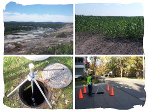
Mine - Quarry - Sandpit - Forestry - Environment
Industrial equipment - Building - Municipal
TerraScan 3D is a company working in the geomatic domains. It offers professional services for the acquisition, processing and analysis of spatial data.
Our services provide full 3D documentation which are faster and safer than conventional surveying methods. The deliverable project documentation becomes an essential tool in helping with the decision making.

Concours québécois en entrepreneuriat
Innovations, technology and technical category

